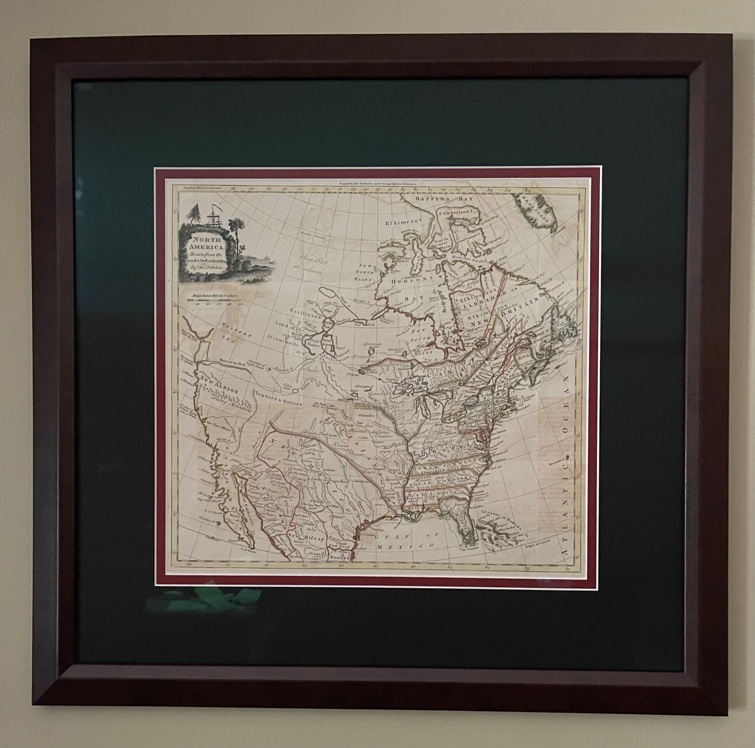
Map of Revolutionary War American c. 1770
Printed in London, 1770
15.5” x 13” – professionally matted and framedPrinted in London, 177015.5” x 13” – professionally matted and framed .Will require seperate shipping invoice to be paid after shipping.
Hand colored, very good condition with minor offsettingEarly map of the British Colonies and the whole of North America, shortly after the conclusion of the French & Indian War and on the eve of Revolutionary War. The colonies are attractively outlined in color, including New England, New York, Pennsylvania, New Jersey, Maryland, Delaware, Virginia, North Carolina, South Carolina, Georgia, West Florida and East Florida. This same map was featured in Todd Andrlik’s award-winning book, Reporting the Revolutionary War, and comes from the author’s private collection.Louisiana is a French possession and New Mexico and New Albion are Spanish Possessions which dominate the West. The Western Sea is noted opposite the Straits Juan De Fuca, although without a coast line in the north and east. The River of the West also remains, with an unbroken course from D'Aguilar's discoveries on the NW Coast to the Mississippi River. Teguayo & Quivira appear, although now shown as a single unit in the region which would roughly correlate with Utah. The Snowy Mountains in California are shown, along with several apocrypal rivers, including the Carmel (Rio Colorado). Drake's landing near San Francisco is noted. Some curiously named Blue Mountains appear in the Northern Baja, not far from San Diego.A number of settlements are shown on the Rio Grande, including a note regarding the Apaches of Seven Rivers. Many Indian names in the interior, including Kansez, Black Padoucas, Padoucas, Panimatia, Eastern Sioux, Outaouas, Outagamis, and Moscoutops. Many other early interesting features. The British Colonial claims on the East Coast run to the Mississippi River. Hand colored, very good condition with minor offsetting Early map of the British Colonies and the whole of North America, shortly after the conclusion of the French & Indian War and on the eve of Revolutionary War. The colonies are attractively outlined in color, including New England, New York, Pennsylvania, New Jersey, Maryland, Delaware, Virginia, North Carolina, South Carolina, Georgia, West Florida and East Florida. This same map was featured in Todd Andrlik’s award-winning book, Reporting the Revolutionary War, and comes from the author’s private collection. Louisiana is a French possession and New Mexico and New Albion are Spanish Possessions which dominate the West. The Western Sea is noted opposite the Straits Juan De Fuca, although without a coast line in the north and east. The River of the West also remains, with an unbroken course from Aguilars discoveries on the NW Coast to the Mississippi River. Teguayo & Quivira appear, although now shown as a single unit in the region which would roughly correlate with Utah. The Snowy Mountains in California are shown, along with several apocrypal rivers, including the Carmel (Rio Colorado). Drakes landing near San Francisco is noted. Some curiously named Blue Mountains appear in the Northern Baja, not far from San Diego. A number of settlements are shown on the Rio Grande, including a note regarding the
Apaches of Seven Rivers. Many Indian names in the interior, including Kansez, Black Padoucas, Padoucas, Panimatia, Eastern Sioux, Outaouas, Outagamis, and Moscoutops. Many other early interesting features. The British Colonial claims on the
East Coast run to the Mississippi River. Ex. Todd Andrlik.


